EdX

GIS Image Analysis in ArcGIS Pro (edX)

GIS Image Analysis in ArcGIS Pro (edX)

Learn fundamentals of remote sensing, image analysis, image processing and its application on real-world problems such as vegetation health, wildfire severity, and flooding. Image analysis is extraction of meaningful information from an image to accomplish a simple task like understanding the landscape or to solve a complex problem like face recognition.

Class Deals by MOOC List - Click here and see EdX's Active Discounts, Deals, and Promo Codes.

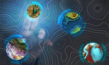
This course is focused on image analysis and applications in the area of natural resource management, geography, geology, and environmental studies. Participants will use a variety of remotely sensed data including Digital Elevation Model, Landsat and Sentinel satellite data to solve specific problems.
Participants in this course will learn fundamentals of remote sensing, image processing and image analysis. Participants will learn image analysis in ESRI ArcGIS Pro through hands-on exercises including image display, image georeferencing, change detection methods, supervised and unsupervised classification, and accuracy assessment methods.
The course is designed for self-study with lessons covering GIS image analysis applications on real-world problems.
This course is part of the Geographic Information Systems (GIS) Essentials Professional Certificate.

What you'll learn

  • Access open source satellite image and data products for any part of the world
  • Perform image analysis using raster functions in ArcGIS Pro software efficiently
  • Co-register and use historic remotely sensed imagery for change detection applications
  • Use spectral indices to assess vegetation health, burn severity, and flooding
  • Use unsupervised and supervised classification algorithms to create land cover maps
  • Create elegant map figures for communicating image analysis results

Syllabus

Week 1: Introduction to GIS Image analysis

  • What is an image? How do you get an image?
  • Image display and image properties
  • Spectral region
  • Basic image operations and enhancements

Week 2: Spectral Indices

  • Spectral indices introduction
  • NDVI and delta_NDVI (for vegetation health)
  • NBR and delta_NBR (for wildfire severity)
  • NDWI and delta_NDWI (for flooding)

Week 3: Image Classification

  • Image classifiers (supervised vs unsupervised)
  • Land cover mapping in ArcGIS Pro
  • Image classification accuracy assessment

Week 4: Landsat/Sentinel sensor applications

  • Landsat sensor
  • Mapping Arctic greening
  • Mapping Aspen Defoliation
  • Mapping lake area change
Go to Class
MOOC List is learner-supported. When you buy through links on our site, we may earn an affiliate commission.

Related Courses

Synthetic Aperture Radar: Hazards (edX) EdX
University of Alaska Fairbanks,AlaskaX

Synthetic Aperture Radar: Hazards (edX)

This course focuses on the applications of Synthetic Aperture Radar (SAR) remote sensing for disaster monitoring. Learn about weather and illumination-independent SAR remote sensing technology, and explore its applications to natural hazards including earthquakes, volcanic eruptions, and flooding.

Self Paced
Self-Paced
Beyond Engineering: Building with Nature (edX) EdX
Delft University of Technology,DelftX

Beyond Engineering: Building with Nature (edX)

Learn how to use Social Design Principles in developing more effective and sustainable hydraulic infrastructure, with an emphasis on delta, coastal and port environments. If you’re a coastal engineer, ecologist or planner, then this is the course for you. You already know that engineering and ecological principles are not enough to realize nature-friendly solutions in practice. You need people on your side!

Self Paced
Self-Paced
Design and innovation of business model (Coursera) Coursera
Tecnológico de Monterrey

Design and innovation of business model (Coursera)

The core of Business Model Design lies in skills and leadership of the entrepreneurial manager. It requires a disciplined approach to seeking opportunities, as well as gathering and aligning resources to achieve important goals. In this course, students will strengthen two important skills: intuition and visual thinking, while applying quantitative methods learned in other courses, such as Finance, Economics and Financial Intelligence.

Jun 8th 2026
4 Weeks
Sparse Representations in Image Processing: From Theory to Practice (edX) EdX
IsraelX

Sparse Representations in Image Processing: From Theory to Practice (edX)

Learn about the deployment of the sparse representation model to signal and image processing. This course is a follow-up to the first introductory course of sparse representations. Whereas the first course puts emphasis on the theory and algorithms in this field, this course shows how these apply to actual signal and image processing needs.

Self Paced
Self-Paced
Basics of Mathematical Modeling of Systems (edX) EdX
National Research Nuclear University MEPhI,MEPhIx

Basics of Mathematical Modeling of Systems (edX)

Basics of scientific visualization in mathematical modeling of systems – the course teaches the basics of scientific visualization of data obtained as a result of mathematical modeling of various systems and processes using C#. The aim of the course is to familiarize the listeners with approaches in scientific visualization of the results obtained from mathematical modeling of various systems and processes using C# with concrete examples.

Self Paced
Self-Paced
Geographical Information Systems - Part 2 (Coursera) Coursera
École Polytechnique Fédérale de Lausanne

Geographical Information Systems - Part 2 (Coursera)

This course is the second part of a course dedicated to the theoretical and practical bases of Geographic Information Systems (GIS). It offers an introduction to GIS that does not require prior computer skills. It gives the opportunity to quickly acquire the basics that allow you to create spatial databases and produce geographic maps. This is a practical course that relies on the use of free Open Source software (QGIS, Geoda).

Jun 8th 2026
5-12 Weeks
Evaluación de peligros y riesgos por fenómenos naturales (Coursera) Coursera
Universidad Nacional Autónoma de México

Evaluación de peligros y riesgos por fenómenos naturales (Coursera)

Reconocer el conocimiento básico sobre los factores físicos y sociales que condicionan el riesgo de una sociedad por fenómenos extremos de origen natural (sismos, huracanes, etc.) y promover las acciones necesarias para reducir el impacto de los desastres en una comunidad.

Jun 8th 2026
4 Weeks
Essential Epidemiologic Tools for Public Health Practice (Coursera) Coursera
Johns Hopkins University

Essential Epidemiologic Tools for Public Health Practice (Coursera)

In order to make a difference in the health and well-being of a population, we must understand the burden of all problems and conditions that affect the population, as well as how well our efforts to mitigate these problems are actually working. This course provides you with some essential skills and tools that will enhance your ability to describe and understand the health of your community

Jun 8th 2026
4 Weeks
Computer Vision and Image Processing Fundamentals (edX) EdX
IBM

Computer Vision and Image Processing Fundamentals (edX)

Learn about computer vision, one of the most exciting fields in machine learning. artificial intelligence and computer science. Computer Vision is one of the most exciting fields in Machine Learning, computer science and AI. It has applications in many industries such as self-driving cars, robotics, augmented reality, face detection in law enforcement agencies.

Self Paced
Self-Paced
3D GIS (edX) EdX
University of Alaska Fairbanks,AlaskaX

3D GIS (edX)

Take your maps into the third dimension: Learn GIS concepts and tools to visualize, analyze, and interpret spatial data in 3D. Reveal patterns that can lead to better decision making. Maps are graphic representations of reality and help us understand and navigate the world around us. Maps can incorporate third dimension through contours, hillshading (3D modeling), and profile views.

Self Paced
Self-Paced