EdX

3D GIS (edX)

3D GIS (edX)

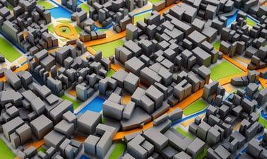
Take your maps into the third dimension: Learn GIS concepts and tools to visualize, analyze, and interpret spatial data in 3D. Reveal patterns that can lead to better decision making. Maps are graphic representations of reality and help us understand and navigate the world around us. Maps can incorporate third dimension through contours, hillshading (3D modeling), and profile views.

Class Deals by MOOC List - Click here and see EdX's Active Discounts, Deals, and Promo Codes.

In this course you will learn fundamentals of third dimension (3D) GIS concepts and tools to visualize, analyze, and interpret geospatial data in 3D, enabling you to reveal patterns and relationships for more effective problem-solving and decision making.
When the data include the third dimension, ArcGIS Scene allows us to navigate through the data in 3D space. This makes the data and the problem more understandable and reveals new visual insights. Visualizing and processing the data in 3D allows us to include real-world elements in the analysis such as undulation of terrain and 3D extent of trees, building, and subsurface geology.
Our world is three dimensional and many GIS applications now require 3D analysis. Esri’s ArcGIS Scene allows us to visualize data on a world sphere. It provides a variety of tools for orientation, navigation, search, data preparation, building workflows and spatial analysis.
3D mapping and visualization is used in a variety of industries and academic disciplines:

  • Monitoring forest stand height and age
  • Volumetric analysis of resource extraction from a mine or water level in a reservoir
  • Watershed delineation to assess inundation risk, land management, environmental monitoring

This course is part of the Geographic Information Systems (GIS) Essentials Professional Certificate.

What you'll learn

  • How to display and navigate 3D data in ArcGIS Scene
  • How to edit and process 3D feature data
  • How to carry out volumetric analysis
  • How to display and process 3D raster Digital Elevation Model data
  • Viewshed and solar radiation analysis
  • Watershed mapping and delineation using Digital Elevation Models
  • Create 3D visualization and presentations
Go to Class
MOOC List is learner-supported. When you buy through links on our site, we may earn an affiliate commission.

Related Courses

Introduction to Geospatial Technology Using QGIS (Canvas.net) Canvas Network
Del Mar College

Introduction to Geospatial Technology Using QGIS (Canvas.net)

This course provides a rich introduction to the booming technology field of Geographic Information Systems, known as GIS. The GIS industry is exploding at double-digit employment and income numbers and promises employment opportunities well into the future. Students will learn the fundamentals of GIS and how to build digital maps using open source software that allows free unlimited use for private or commercial applications. All data and software required is included in the course.

No sessions available
No Information
Geographical Information Systems - Part 2 (Coursera) Coursera
École Polytechnique Fédérale de Lausanne

Geographical Information Systems - Part 2 (Coursera)

This course is the second part of a course dedicated to the theoretical and practical bases of Geographic Information Systems (GIS). It offers an introduction to GIS that does not require prior computer skills. It gives the opportunity to quickly acquire the basics that allow you to create spatial databases and produce geographic maps. This is a practical course that relies on the use of free Open Source software (QGIS, Geoda).

Aug 31st 2026
5-12 Weeks
Computational Geometry (Coursera) Coursera
Saint Petersburg State University

Computational Geometry (Coursera)

This course represents an introduction to computational geometry – a branch of algorithm theory that aims at solving problems about geometric objects. Its application areas include computer graphics, computer-aided design and geographic information systems, robotics, and many others. You will learn to apply to this end various algorithmic approaches, and asses their strong and weak points in a particular context, thus gaining an ability to choose the most appropriate method for a concrete problem.

May 16th 2022
5-12 Weeks
Cartography (Esri) Esri
Esri

Cartography (Esri)

Once, only cartographers made maps. Today anyone can. Still, cartographers can teach people to make better maps, just as chefs can show people how to cook better meals. With coaching from experienced cartographers and practical, hands-on exercises using ArcGIS Pro, you'll become a smarter mapmaker, ready to go beyond the defaults and make better maps.

Feb 16th 2022
5-12 Weeks
Do-It-Yourself Geo Apps (Esri) Esri
Esri

Do-It-Yourself Geo Apps (Esri)

You don’t have to be a software developer to build valuable geo-enabled apps that make your communities smarter and businesses more successful. This course will show you how to combine location and narrative in one application to better communicate and broadcast your story, create custom web applications that solve problems in your community, and build powerful native applications for iOS and Android devices without touching a piece of code.

Jan 26th 2022
4 Weeks
Geohealth: Improving Public Health through Geographic Information (FutureLearn) FutureLearn
University of Twente

Geohealth: Improving Public Health through Geographic Information (FutureLearn)

Explore how spatial data and geographic information systems (GIS) can be used to understand and improve public health. The environment in which we live and work can have a profound effect on our health – an effect that is explored by the emerging field of geohealth. This free online course will introduce you to new developments in geohealth, looking at the latest thinking and methods for using spatial data and geographic information systems (GIS) in health settings.

No sessions available
4 Weeks
Statistics Using Python (edX) EdX
University of Wisconsin–Madison,WisconsinX

Statistics Using Python (edX)

Learn the fundamentals of statistics using Python. This course is a compact primer in statistics as a foundation for data-driven business analysis. A selection of concepts include descriptive statistics, probability, inference, correlation, and regression. The course also exposes students to basic Python programming for use in statistics.

Sep 2nd 2026
5-12 Weeks
Modellazione digitale 3D: input (POK) Polimi OPEN KNOWLEDGE
Politecnico di Milano

Modellazione digitale 3D: input (POK)

Importare, georeferenziare e gestire, in ambiente CAD, database cartografici e fotogrammetrici. Il programma, di carattere prettamente operativo, si propone di fornire indicazioni pratiche per l’acquisizione e la gestione di cartografia da geoportale, per l’acquisizione e la gestione di dati metrico spaziali acquisiti tramite scansione 3D in ambiente reale, e per la georeferenziazione e integrazione delle informazioni in ambiente CAD.

Available
2 Weeks
Spatial Analysis and Satellite Imagery in a GIS (Coursera) Coursera
University of Toronto

Spatial Analysis and Satellite Imagery in a GIS (Coursera)

In this course, you will learn how to analyze map data using different data types and methods to answer geographic questions. First, you will learn how to filter a data set using different types of queries to find just the data you need to answer a particular question. Then, we will discuss simple yet powerful analysis methods that use vector data to find spatial relationships within and between data sets.

Aug 24th 2026
5-12 Weeks
Imagery, Automation, and Applications (Coursera) Coursera
University of California, Davis

Imagery, Automation, and Applications (Coursera)

Welcome to the last course of the specialization (unless your continuing on to the capstone project, of course!). Using the knowledge you’ve learned about ArcGIS, complete technical tasks such raster calculations and suitability analysis. What you will learn:Use the imagery in two different common types of analysis: NDVI and trained classification; Practice with tools to support image analysis using Raster Calculation and Spatial Analyst; Develop a large processing workflow in ModelBuilder; Use products derived from digital elevation models

Jun 17th 2024
4 Weeks