EdX

Synthetic Aperture Radar: Hazards (edX)

Synthetic Aperture Radar: Hazards (edX)

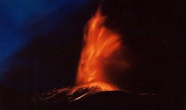
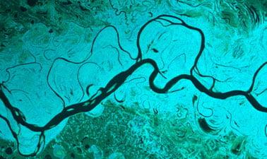
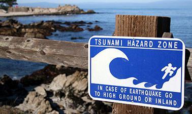
This course focuses on the applications of Synthetic Aperture Radar (SAR) remote sensing for disaster monitoring. Learn about weather and illumination-independent SAR remote sensing technology, and explore its applications to natural hazards including earthquakes, volcanic eruptions, and flooding.

Class Deals by MOOC List - Click here and see EdX's Active Discounts, Deals, and Promo Codes.

Remote sensing observations from airborne and spaceborne platforms have become an essential tool in disaster management. They provide an immediate and large-area overview of evolving disaster situations, revealing important hazard information to disaster response personnel.

This course will introduce you to Synthetic Aperture Radar (SAR), a remote sensing technology that can see the ground even during darkness and through rain, clouds, or smoke. As a participant in this course, you will gain an intuitive understanding of the information contained in SAR observations and learn to use a range of analysis techniques to apply SAR data to disaster mapping and management. Specific topics will include:

  • The mathematical and physical principles of SAR remote sensing
  • How to access and visualize SAR data
  • Interpretation of SAR images in the context of disaster monitoring
  • Interferometric SAR (InSAR) concepts
  • Flood mapping and SAR change detection for hazard analysis

The learned concepts will be put into action in simulated disaster response exercises, in which class participants will analyze SAR data sets to create hazard information for several real-life disaster events from the recent past.
Learners registered for the verified track will additionally get the opportunity for hands-on lab exercises using Jupyter Notebooks. The verified track will also include peer discussions and a verified certificate upon successful completion.
This course is part of the Synthetic Aperture Radar (SAR): Applications Professional Certificate.

Prerequisites:

  • General proficiency in GIS
  • For verified track: Basic knowledge in Python programming
  • ARSET Level-0 Training “Fundamentals of Remote Sensing” or equivalent
  • ARSET Level-1 Training “Introduction to Synthetic Aperture Radar” or equivalent

What you'll learn
Participants in this course will develop the following skills:

  • Intuitive understanding of SAR image and phase information
  • Understanding the properties of different SAR sensor types
  • Ability to pick the optimal sensor for your application
  • Creation of RGB color visualizations from images acquired at different times or in different polarizations
  • Use of SAR images to map hazards such as flooding and deforestation
  • Use of interferometric SAR techniques to measure cm-scale surface deformation related to volcanic activity and landslides

Syllabus

Week 1: Course Introduction and Basic Capabilities of SAR & InSAR
Week 1 will introduce you to the main content and structure of this course. You will also learn about the lab environment that will be available for learners on the “verified track”. The following items will be addressed:

  • Introduction to course
  • Presentation of course syllabus
  • Basic principles and capabilities of Synthetic Aperture Radar (SAR) imaging
  • Concepts of Interferometric SAR processing and its applications to disaster monitoring
  • Verified Track: Lab exercise on exploring SAR time series for flooding events
  • Verified Track: Lab exercise analyzing and interpreting InSAR products

Week 2: InSAR Time Series Analysis Techniques
InSAR time series analysis techniques enable the tracking of cm-scale surface displacements over long times. These techniques are relevant for a number of hazard applications such as landslide and volcano monitoring. In Week 2 we will address:

  • The Concept of InSAR Time Series Analysis
  • Point Target-Based InSAR Time Series Analysis
  • Distributed Scatterer InSAR Time Series Analysis
  • Verified Track: Lab exercise exploring PSI time series data over Norway

Week 3: Disaster Monitoring using SAR Image Data
SAR sensors are highly stable imaging systems that are ideal for the identification of changes on the earth surface. Week 3 will introduce participants to a range of techniques to monitor hazard events and identify changes from multi-temporal SAR images.

  • Surface water signatures in SAR
  • A Threshold-based surface water mapping method
  • Verified Track: Hands-on flood mapping using Jupyter Notebooks
  • SAR change detection techniques
  • Verified Track: Lab exercise on time series change detection to map deforestation

Week 4: Disaster Monitoring using InSAR Techniques
In this part of the course, we will apply the information learned in Week 4 to monitor surface displacements at volcanoes and in landslide-prone areas. Specifically, Week 6 will address the following items:

  • Review of InSAR workflow for a geophysical application
  • Estimating volcano source model parameters from InSAR
  • Verified Track: Lab exercise estimating Mogi source parameters for Okmok volcano, Alaska
  • Landslides monitoring using SBAS InSAR
  • Verified Track: Lab exercise mapping landslide motion in California using InSAR time series data
Go to Class
MOOC List is learner-supported. When you buy through links on our site, we may earn an affiliate commission.

Related Courses

Flood Risk Management (edX) EdX
RWTH Aachen,Technische Universität München - TUM,RWTHx,TUMx

Flood Risk Management (edX)

Understand the fundamentals of flood risk management and forecasting and learn how to implement ideas and measures to prevent damage. In the last decades, the reported damages caused by natural hazards increased tremendously. Flood risk management aims to prevent the loss of properties, assets and life caused by floods. The MOOCs focus is on aspects of flood risk management, forecasting and protection measures.

No sessions available
5-12 Weeks
Volcanic hazards (edX) EdX
University of Canterbury,UCx

Volcanic hazards (edX)

In this course, we will take you on an interactive tour around Icelandic volcanoes where we will be talking to experts on location, digging holes to discover past eruptions, and hearing amazing stories of survival. We will discuss how to better manage volcanic hazards, using examples of volcanoes in Iceland and Aotearoa New Zealand.

Self Paced
Self-Paced
Planet Earth ... and You! (Coursera) Coursera
University of Illinois at Urbana-Champaign

Planet Earth ... and You! (Coursera)

Earthquakes, volcanoes, mountain building, ice ages, landslides, floods, life evolution, plate motions—all of these phenomena have interacted over the vast expanses of deep time to sculpt the dynamic planet that we live on today. Planet Earth presents an overview of several aspects of our home, from a geological perspective. We begin with earthquakes—what they are, what causes them, what effects they have, and what we can do about them. We will emphasize that plate tectonics—the grand unifying theory of geology—explains how the map of our planet's surface has changed radically over geologic time, and why present-day geologic activity—including a variety of devastating natural disasters such as earthquakes—occur where they do. We consider volcanoes, types of eruptions, and typical rocks found there.

Jul 27th 2026
5-12 Weeks
Monitoring the Oceans from Space (FutureLearn) FutureLearn
EUMETSAT

Monitoring the Oceans from Space (FutureLearn)

Explore our oceans from space. Discover how Earth observation allows us to monitor ocean health, and inform policy and planning. This free online course will provide an introduction to ocean monitoring Earth Observation (EO) satellite data, and its uses, types and challenges. It will explain how the data is acquired and used, the range of data types available, and the terminology and techniques involved.

No sessions available
5-12 Weeks
Risk Communication (KTU) Other Providers
Kaunas University of Technology - KTU

Risk Communication (KTU)

This MOOC provides practical tips, hands-on tools and the most recent examples for the effective risk communication. Course is open for everyone who is interested in individual, national or global risks in contemporary world and would like to acquire skills in designing, visualising and using media for risk messages. This course is based on the Erasmus+ project "Risk and Security Governance Studies within Baltic – Nordic Academic Community of Practice".

No sessions available
5-12 Weeks
Be Ready: Staying Safe During Disasters (FutureLearn) FutureLearn
International Federation of Red Cross and Red Crescent Societies

Be Ready: Staying Safe During Disasters (FutureLearn)

Learn about the key preparedness actions you can take to stay safe during various disasters and extreme weather events. Discover what to do when disaster strikes. As extreme weather events continue to affect the lives of millions of people across the globe, it’s never been more important to know how to stay safe when disaster strikes. On this course, you’ll find out about the key actions you can take to reduce the risks associated with disasters and extreme weather events.

No sessions available
2 Weeks
Seismology to Earthquake Engineering (Coursera) Coursera
École Polytechnique

Seismology to Earthquake Engineering (Coursera)

This course ranges from the earth structure, the generation of earthquakes and seismic waves by faults to the seismic response of soils, foundations and structures as well as seismic risk. It is consequently aimed at undergraduates, graduates and professionals interested in engineering seismology, earthquake engineering or seismic risk. It investigates various technical fields: rock mechanics, soil dynamics, structural dynamics and dynamic soil-structure interaction.

Aug 17th 2026
5-12 Weeks
Fundamentals of Statistics (edX) EdX
MIT,MITx

Fundamentals of Statistics (edX)

Develop a deep understanding of the principles that underpin statistical inference: estimation, hypothesis testing and prediction. Statistics is the science of turning data into insights and ultimately decisions. Behind recent advances in machine learning, data science and artificial intelligence are fundamental statistical principles. The purpose of this class is to develop and understand these core ideas on firm mathematical grounds starting from the construction of estimators and tests, as well as an analysis of their asymptotic performance.

Aug 26th 2026
13-24 Weeks