Éléments de Géomatique (Coursera)

Éléments de Géomatique (Coursera)

Les nouvelles technologies de l’information ont facilité l’accès à de nombreuses bases de données offrant au grand public, mais surtout aux professionnels, une multitude de services. Le domaine de l’information géographique a également suivi ce mouvement en modernisant l’ensemble des supports, des plans, des cartes topographiques et de tous les types de données à référence spatiale. Face au déploiement massif des cartes numériques et des nombreux services basés sur la localisation, il s’agit de rester critique et surtout de développer les capacités nécessaires afin de choisir les outils et jeux de géodonnées adaptés aux besoins professionnels.

Class Deals by MOOC List - Click here and see Coursera's Active Discounts, Deals, and Promo Codes.

C’est dans cette optique que ce cours propose de développer les éléments fondamentaux de la géomatique en décrivant les domaines clés que sont: les références géodésiques, les techniques d’acquisition des géodonnées, la topométrie, la localisation par satellites et la modélisation et représentation du terrain.
Cet enseignement est proposé aux futurs ingénieurs et architectes qui ont recours aux géodonnées pour la réalisation de projets d’aménagement, de construction, de gestion de l’environnement, de transport et de développement territorial. Dans ces domaines, l’accès aux données à référence spatiale ainsi qu’une connaissance des sources d’information et de leur qualité sont donc primordiales pour la conduite de projets.

Syllabus

WEEK 1
Introduction à la géomatique
Cette introduction vous permet de faire vos premiers pas dans la géomatique en manipulant quelques concepts simples.

WEEK 2
Bases de géodésie : introduction
La géodésie consiste à déterminer la forme et les dimensions de la Terre.

WEEK 3
Bases de géodésie : références et projections
Les références géodésiques permettent de définir les coordonnées de points à la surface de la Terre.

WEEK 4
Cartographie
La cartographie est la méthode qui permet de représenter fidèlement et de manière synthétique des données d'un pays ou d'un territoire.

WEEK 5
Modèles Numériques d'Altitude
L'informatique permet à tout un chacun de créer et manipuler une modélisation du terrain sous forme numérique. Ces modélisations sont utilisés dans des outils de conception et de simulation pour l’ingénierie et l'aménagent.

WEEK 6
Nivellement géométrique
Le nivellement est l'opération de base de la topométrie qui permet de déterminer des altitudes en tenant compte de la gravité.

WEEK 7
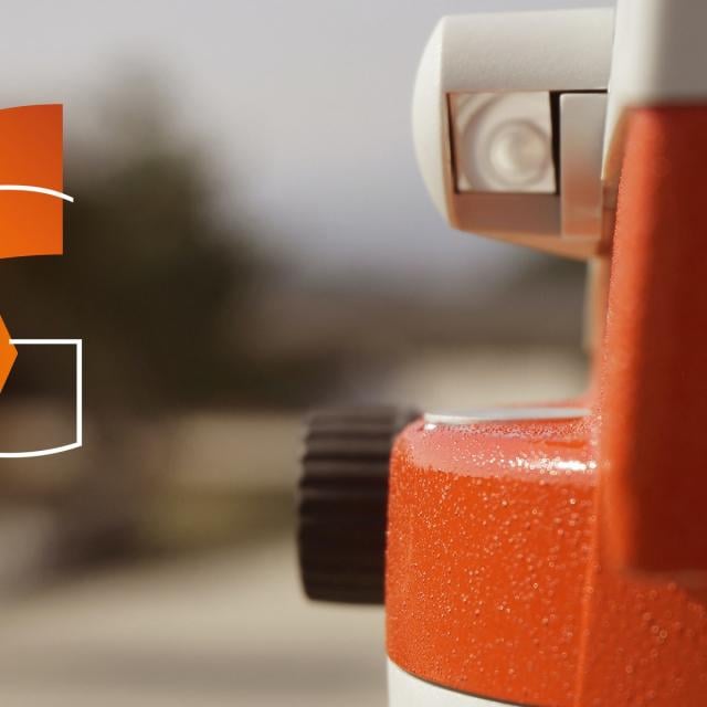
Théodolite : orientation
Le théodolite est l'instrument emblématique de la topométrie qui permet de mesurer des angles entre des points sur le terrain.

WEEK 8
Théodolite : lever polaire
Le lever polaire est l'opération essentielle de la topométrie qui permet de déterminer les coordonnées de nouveaux points à partir de mesures d'angles et de distances.

WEEK 9
Mesures et corrections de distances
Les mesures électroniques de distances doivent subirent un certain nombre de corrections pour être compatibles avec un canevas de points en coordonnées nationales.

WEEK 10
Localisation par satellites
La localisation par satellites est une branche moderne de la Géomatique qui permet de déterminer une position de l'espace en utilisant des signaux provenant d'une constellation de satellites.

WEEK 11
Conclusion
Après ce cours sur les éléments de géomatique, nous vous donnons un résumé suivi de deux exemples pratiques qui illustrent les méthodes d'acquisition et de représentation de géodonnées. Nous profitons de l'occasion pour vous remercier pour votre participation active à ce cours.

Go to Class
MOOC List is learner-supported. When you buy through links on our site, we may earn an affiliate commission.

Related Courses

GIS, Mapping, and Spatial Analysis Capstone (Coursera) Coursera
University of Toronto

GIS, Mapping, and Spatial Analysis Capstone (Coursera)

In this capstone course, you will apply everything you have learned by designing and then completing your own GIS project. You will plan out your project by writing a brief proposal that explains what you plan to do and why. You will then find data for a topic and location of your choice, and perform analysis and create maps that allow you to try out different tools and data sets. The results of your work will be assembled into an Esri story map, which is a web site with maps, images, text, and video. The goal is for you to have a finished product that you can share, and that demonstrates what you have learned.

Jun 15th 2026
5-12 Weeks
GIS Image Analysis in ArcGIS Pro (edX) EdX
University of Alaska Fairbanks,AlaskaX

GIS Image Analysis in ArcGIS Pro (edX)

Learn fundamentals of remote sensing, image analysis, image processing and its application on real-world problems such as vegetation health, wildfire severity, and flooding. Image analysis is extraction of meaningful information from an image to accomplish a simple task like understanding the landscape or to solve a complex problem like face recognition.

Self Paced
Self-Paced
The Science of the Solar System (Coursera) Coursera
Caltech

The Science of the Solar System (Coursera)

Learn about the science behind the current exploration of the solar system in this free class. Use principles from physics, chemistry, biology, and geology to understand the latest from Mars, comprehend the outer solar system, ponder planets outside our solar system, and search for habitability in our neighborhood and beyond. This course is generally taught at an advanced level assuming a prior knowledge of undergraduate math and physics, but the majority of the concepts and lectures can be understood without these prerequisites.

Jun 22nd 2026
5-12 Weeks
Computational Watershed Hydrology (edX) EdX
Purdue University,PurdueX

Computational Watershed Hydrology (edX)

Learn how to perform hydrologic analysis and modeling using real observations, geospatial data, and computational tools. Students in this class will learn how to access and process commonly used geospatial and temporal data such as the digital elevation model (DEM), land use, soil, streamflow and precipitation using geographic information systems (GIS).

Jan 10th 2022
13-24 Weeks
Geohealth: Improving Public Health through Geographic Information (FutureLearn) FutureLearn
University of Twente

Geohealth: Improving Public Health through Geographic Information (FutureLearn)

Explore how spatial data and geographic information systems (GIS) can be used to understand and improve public health. The environment in which we live and work can have a profound effect on our health – an effect that is explored by the emerging field of geohealth. This free online course will introduce you to new developments in geohealth, looking at the latest thinking and methods for using spatial data and geographic information systems (GIS) in health settings.

No sessions available
4 Weeks
Modellazione digitale 3D: input (POK) Polimi OPEN KNOWLEDGE
Politecnico di Milano

Modellazione digitale 3D: input (POK)

Importare, georeferenziare e gestire, in ambiente CAD, database cartografici e fotogrammetrici. Il programma, di carattere prettamente operativo, si propone di fornire indicazioni pratiche per l’acquisizione e la gestione di cartografia da geoportale, per l’acquisizione e la gestione di dati metrico spaziali acquisiti tramite scansione 3D in ambiente reale, e per la georeferenziazione e integrazione delle informazioni in ambiente CAD.

Available
2 Weeks
Introduction to Geospatial Technology Using QGIS (Canvas.net) Canvas Network
Del Mar College

Introduction to Geospatial Technology Using QGIS (Canvas.net)

This course provides a rich introduction to the booming technology field of Geographic Information Systems, known as GIS. The GIS industry is exploding at double-digit employment and income numbers and promises employment opportunities well into the future. Students will learn the fundamentals of GIS and how to build digital maps using open source software that allows free unlimited use for private or commercial applications. All data and software required is included in the course.

No sessions available
No Information
Geographical Information Systems - Part 2 (Coursera) Coursera
École Polytechnique Fédérale de Lausanne

Geographical Information Systems - Part 2 (Coursera)

This course is the second part of a course dedicated to the theoretical and practical bases of Geographic Information Systems (GIS). It offers an introduction to GIS that does not require prior computer skills. It gives the opportunity to quickly acquire the basics that allow you to create spatial databases and produce geographic maps. This is a practical course that relies on the use of free Open Source software (QGIS, Geoda).

Jun 8th 2026
5-12 Weeks
Geodesign: Change Your World (Coursera) Coursera
Pennsylvania State University

Geodesign: Change Your World (Coursera)

What happens when creativity and science come together? The power to design our world is unleashed, providing tools to inform choices about how we live! Geodesign is the glue—it’s a process that deploys creativity to connect information to people, using collaboration to better inform how we design our world.

Jun 22nd 2026
5-12 Weeks