Spatial Analysis

Filter Courses within "Spatial Analysis" (Click to filter)
Imagery, Automation, and Applications (Coursera) Coursera
University of California, Davis

Imagery, Automation, and Applications (Coursera)

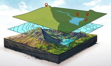
Dive into the final chapter of our specialization series where you'll master the art of imagery and automation within geographic information systems (GIS). This course focuses on leveraging ArcGIS to perform complex tasks such as raster calculations, NDVI (Normalized Difference Vegetation Index) analysis, and trained classification. You will also explore ModelBuilder for developing intricate processing workflows and learn how to utilize products derived from digital elevation models.

Jun 17th 2024
4 Weeks
Spatial Data Science: The New Frontier in Analytics (Esri) Esri
Esri

Spatial Data Science: The New Frontier in Analytics (Esri)

Embark on a transformative journey into Spatial Data Science with this comprehensive online course from Esri. Over the span of six weeks, you'll dive deep into leveraging spatial data to revolutionize your approach to analytics. Master the art of analyzing geospatial information, solving intricate problems, and presenting findings through cutting-edge mapping technologies and applications.

Oct 5th 2022
5-12 Weeks
Going Places with Spatial Analysis (Esri) Esri
Esri

Going Places with Spatial Analysis (Esri)

Discover the transformative potential of spatial data analysis with 'Going Places with Spatial Analysis' by Esri. This course is designed for data analysts looking to delve deeper into their field, offering a unique approach through spatial data. Gain free access to ArcGIS Online's full suite of analytical tools and learn how to apply them effectively.

Apr 13th 2022
5-12 Weeks
Spatial Analysis with SAP HANA Platform (openSAP) OpenSAP
SAP

Spatial Analysis with SAP HANA Platform (openSAP)

Discover how to harness the potential of spatial data with our 'Spatial Analysis with SAP HANA Platform' course. This course will equip you with the skills needed to analyze and develop geospatial applications using SAP HANA’s innovative technology. Learn about in-memory data management, geo-content, services, and more to enhance your organization's analytical capabilities.

Self Paced
Self-Paced
GIS Foundations (edX) EdX
University of Alaska Fairbanks,AlaskaX

GIS Foundations (edX)

Discover the fundamentals of Geographic Information Systems (GIS) with our beginner-friendly course. Gain a deep understanding of GIS concepts and geospatial technology to unlock new ways of viewing, analyzing, and interpreting geographical data. Perfect for those looking to solve complex problems and make informed decisions based on spatial data.

Self Paced
Self-Paced
‹ Previous Page 2