Spatial Analysis and Satellite Imagery in a GIS (Coursera)

Offered by University of Toronto,
Spatial Analysis and Satellite Imagery in a GIS (Coursera)

In this course, you will learn how to analyze map data using different data types and methods to answer geographic questions. First, you will learn how to filter a data set using different types of queries to find just the data you need to answer a particular question. Then, we will discuss simple yet powerful analysis methods that use vector data to find spatial relationships within and between data sets.

Class Deals by MOOC List - Click here and see Coursera's Active Discounts, Deals, and Promo Codes.

In this section, you will also learn about how to use ModelBuilder, a simple but powerful tool for building analysis flowcharts that can then also be run as models. You will then learn how to find, understand, and use remotely sensed data such as satellite imagery, as a rich source of GIS data. You will then learn how to analyze raster data. Finally, you will complete your own project where you get to try out the new skills and tools you have learned about in this course.
Note: software is not provided for this course.

Course 3 of 4 in the GIS, Mapping, and Spatial Analysis Specialization.

Syllabus

WEEK 1: Filtering Data Using Queries
WEEK 2: Vector analysis
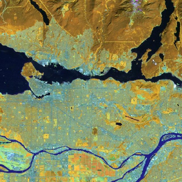
WEEK 3: Remote sensing as a GIS data source
WEEK 4: Raster analysis
WEEK 5: Project: Spatial Analysis

Go to Class
MOOC List is learner-supported. When you buy through links on our site, we may earn an affiliate commission.

Related Courses

Geospatial and Environmental Analysis (Coursera) Coursera
University of California, Davis

Geospatial and Environmental Analysis (Coursera)

Apply your GIS knowledge in this course on geospatial analysis, focusing on analysis tools, 3D data, working with rasters, projections, and environment variables. Through all four weeks of this course, we'll work through a project together - something unique to this course - from project conception, through data retrieval, initial data management and processing, and finally to our analysis products.

Mar 18th 2024
4 Weeks
Visual Analytics with Tableau (Coursera) Coursera
University of California, Davis

Visual Analytics with Tableau (Coursera)

In this third course of the specialization, we’ll drill deeper into the tools Tableau offers in the areas of charting, dates, table calculations and mapping. We’ll explore the best choices for charts, based on the type of data you are using. We’ll look at specific types of charts including scatter plots, Gantt charts, histograms, bullet charts and several others, and we’ll address charting guidelines.

Jun 29th 2026
4 Weeks
Cartography (Esri) Esri
Esri

Cartography (Esri)

Once, only cartographers made maps. Today anyone can. Still, cartographers can teach people to make better maps, just as chefs can show people how to cook better meals. With coaching from experienced cartographers and practical, hands-on exercises using ArcGIS Pro, you'll become a smarter mapmaker, ready to go beyond the defaults and make better maps.

Feb 16th 2022
5-12 Weeks
Computational Watershed Hydrology (edX) EdX
Purdue University,PurdueX

Computational Watershed Hydrology (edX)

Learn how to perform hydrologic analysis and modeling using real observations, geospatial data, and computational tools. Students in this class will learn how to access and process commonly used geospatial and temporal data such as the digital elevation model (DEM), land use, soil, streamflow and precipitation using geographic information systems (GIS).

Jan 10th 2022
13-24 Weeks
Diseño e innovación de modelo de negocios (Coursera) Coursera
Tecnológico de Monterrey

Diseño e innovación de modelo de negocios (Coursera)

El núcleo del Diseño de Modelo de Negocios se encuentra en las habilidades y liderazgo del manager emprendedor. Requiere un enfoque disciplinado para buscar oportunidades, asi como reunir y alinear recursos para alcanzar objetivos importantes. En este curso, los alumnos fortaleceran dos habilidades importantes: la intuición y el pensamiento visual, a la vez que aplican métodos cuantitativos aprendidos en otros cursos, como Finanzas, Economía e Inteligencia Financiera.

Jun 22nd 2026
4 Weeks
Motion Planning for Self-Driving Cars (Coursera) Coursera
University of Toronto

Motion Planning for Self-Driving Cars (Coursera)

Welcome to Motion Planning for Self-Driving Cars, the fourth course in University of Toronto’s Self-Driving Cars Specialization. This course will introduce you to the main planning tasks in autonomous driving, including mission planning, behavior planning and local planning. By the end of this course, you will be able to find the shortest path over a graph or road network using Dijkstra's and the A* algorithm, use finite state machines to select safe behaviors to execute, and design optimal, smooth paths and velocity profiles to navigate safely around obstacles while obeying traffic laws.

Nov 25th 2021
5-12 Weeks
Design and innovation of business model (Coursera) Coursera
Tecnológico de Monterrey

Design and innovation of business model (Coursera)

The core of Business Model Design lies in skills and leadership of the entrepreneurial manager. It requires a disciplined approach to seeking opportunities, as well as gathering and aligning resources to achieve important goals. In this course, students will strengthen two important skills: intuition and visual thinking, while applying quantitative methods learned in other courses, such as Finance, Economics and Financial Intelligence.

Jun 22nd 2026
4 Weeks
Introduction aux Systèmes d’Information Géographique - Partie 1 (Coursera) Coursera
École Polytechnique Fédérale de Lausanne

Introduction aux Systèmes d’Information Géographique - Partie 1 (Coursera)

Organisé en deux parties, ce cours présente les bases théoriques et pratiques des systèmes d’information géographique. - Il propose une introduction aux systèmes d’information géographique qui ne requiert pas de connaissances préalables en informatique - Il donne la possibilité d’acquérir rapidement les notions de base qui vous permettent de créer des bases de données spatiales et de fabriquer des cartes géographiques - Il s’agit d’un cours pratique qui repose sur l’utilisation de logiciels libres, notamment QGIS.

Jun 29th 2026
5-12 Weeks
Clinical Data Models and Data Quality Assessments (Coursera) Coursera
University of Colorado System

Clinical Data Models and Data Quality Assessments (Coursera)

This course aims to teach the concepts of clinical data models and common data models. Upon completion of this course, learners will be able to interpret and evaluate data model designs using Entity-Relationship Diagrams (ERDs), differentiate between data models and articulate how each are used to support clinical care and data science, and create SQL statements in Google BigQuery to query the MIMIC3 clinical data model and the OMOP common data model.

Jun 29th 2026
5-12 Weeks
VLSI CAD Part II: Layout (Coursera) Coursera
University of Illinois at Urbana-Champaign

VLSI CAD Part II: Layout (Coursera)

A modern VLSI chip is a remarkably complex beast: billions of transistors, millions of logic gates deployed for computation and control, big blocks of memory, embedded blocks of pre-designed functions designed by third parties (called “intellectual property” or IP blocks). How do people manage to design these complicated chips? Answer: a sequence of computer aided design (CAD) tools takes an abstract description of the chip, and refines it step-wise to a final design.

Jun 29th 2026
5-12 Weeks