EdX

Drones for Agriculture: Prepare and Design Your Drone (UAV) Mission (edX)

Drones for Agriculture: Prepare and Design Your Drone (UAV) Mission (edX)

Take a dive and expand your knowledge about drones en drone technology. Learn how to prepare and execute a flight mission with an Unmanned Aerial Vehicle (UAV) and how to use, process and understand the collected drone data for your own applications.

Class Deals by MOOC List - Click here and see EdX's Active Discounts, Deals, and Promo Codes.

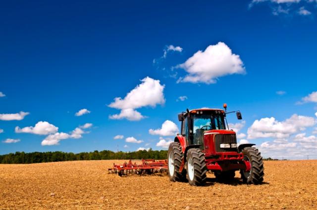
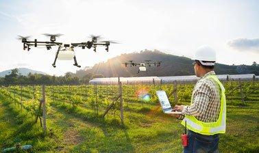
We are all getting familiar with the image of a drone in the sky. Although flying a drone is fun, drones are not toys. More and more UAVs or drones are used by governments and companies to gain answers and insights on nature, agricultural and metropolitan challenges among other fields. For example, small Drones/UAVs (Unmanned Aerial Systems) are employed in agriculture for crop observation, crop monitoring, field analysis and map generation through aerial surveys. And with the available software and 'mission planning tools' market growing, so is the demand for knowledge and understanding about its usage and limitations.
Our top professors of the 'Information Technology Group' and the 'Laboratory of Geo-Information Science and Remote Sensing group' of Wageningen University & Research will teach you whether it makes sense to use drones for your application, challenge or question. You will learn how to plan an end-to-end mission (from image acquisition to data visualization) for your specific drone application and how to execute a drone mission safely. Afther finishing this online course you will have gained full understanding of the aerial mapping workflow and how to implement it in a programmable small drone. You will know which steps you need to take to gain the valuable insights you are looking for.

Do I need a drone to complete this course?
No! You do not need a drone to complete this course. For all the assignments and exercises we will provide the necessary material (in case it is needed). But, we expect to pick your curiosity with this course and hopefully nudge you into buying one and joining the community ;).

For who
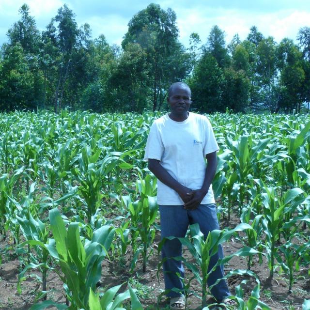
Although the course is initially made for agriculture technicians, researchers or graduate students from multidisciplinary technical fields, everyone that aims to learn how to use an off-the-shelf small drone for generating a high-resolution image from a field, or has a general high interest in drones, is very welcome.

What you'll learn

  • Learn to decide whether it makes sense to use a drone for your application or challenge
  • Design a process from acquisition to data visualization and evaluation for your specific drone application
  • Learn about the available airborne technology and software
  • Understand what UAV international legislation and regulations are concerning drones
  • How to make an aerial surveying workflow
  • How to make the required flight preparations and create- and execute a safe mission setup
  • You will learn about mission planning and the available open source and commercial tools
  • You will gain understanding about aerial imaging product delivery

Syllabus

Module 1: Remote Sensing, UAV's and Applications
In this module you will learn about what Remote Sensing is and how we can use UAVs as tool for our applications. We will explore the possibilities that airborne technology offers.
Module 2: Planning a mission and acquiring the data
During module 2 we will cover the steps that need to be followed when planning a mission, how to do it, what is needed and what to look out for and how the data is acquired.
Module 3: From acquisition to visualisation
Module 3 focuses on evaluating and processing the data that we have obtained during the mission and how we can process it to deliver a product instead of just a photo gallery! This module will also show some simple examples of data processing techniques used in academia and professional work.

Go to Class
MOOC List is learner-supported. When you buy through links on our site, we may earn an affiliate commission.

Related Courses

Sustainable Agricultural Land Management (Coursera) Coursera
University of Florida

Sustainable Agricultural Land Management (Coursera)

This course will cover the agricultural and urban water quality issues in Florida, their bases, land and nutrient management strategies, and the science and policy behind the best management practices (BMPs). Students will learn to evaluate BMP research and analyze its role in determining practices and policies that protect water quality.

Jun 15th 2026
5-12 Weeks
Agriculture, Economics and Nature (Coursera) Coursera
University of Western Australia

Agriculture, Economics and Nature (Coursera)

Sound economic thinking is crucial for farmers because they depend on good economic decision making to survive. Governments depend on economic information to make good policy decisions on behalf of the community. This course will help you to contribute to better decision making by farmers, or by agencies servicing agriculture, and it will help you to understand why farmers respond to policies and economic opportunities in the ways they do.

Jun 8th 2026
5-12 Weeks
Climate Change and Resilience in Food Systems (FutureLearn) FutureLearn
University of Leeds,Africap

Climate Change and Resilience in Food Systems (FutureLearn)

Learn new research-led strategies designed to mitigate the effects of climate change on agriculture and food systems. Learn about the effects of climate change and how to build resilience in agriculture and food systems. Even small climate changes can have large-scale consequences in agriculture and food systems with devastating effects for the people and their economies. On this course, you will learn strategies designed to mitigate the impact of climate change, develop resilient food systems and create sustainable development in local communities.

Sep 23rd 2024
2 Weeks
Remote Sensing Image Acquisition, Analysis and Applications (Coursera) Coursera
UNSW Sydney - University of New South Wales

Remote Sensing Image Acquisition, Analysis and Applications (Coursera)

Welcome to Remote Sensing Image Acquisition, Analysis and Applications, in which we explore the nature of imaging the earth's surface from space or from airborne vehicles. This course covers the fundamental nature of remote sensing and the platforms and sensor types used. It also provides an in-depth treatment of the computational algorithms employed in image understanding, ranging from the earliest historically important techniques to more recent approaches based on deep learning.

May 4th 2026
13-24 Weeks
Drainage in Agriculture: controlling water and salt levels in the soil (edX) EdX
Wageningen University,WageningenX

Drainage in Agriculture: controlling water and salt levels in the soil (edX)

Get prepared for heavier rainfall and the increasing demand for food! The #1 Agricultural University of the world will teach you how to design and implement effective drainage systems in agriculture. You will learn how to create a perfect soil profile for optimal growing conditions for a crop and help feed the growing world population. Enrol now and prepare for the effects of climate change by draining excess water.

Self Paced
Self-Paced
Coberturas de riesgo con futuros y opciones para agrobusiness (Coursera) Coursera
Universidad Austral

Coberturas de riesgo con futuros y opciones para agrobusiness (Coursera)

La producción agropecuaria y agroalimentaria tiene una gran importancia en las economías latinoamericanas tanto desde el punto de vista de su participación en el PBI de los países, generación de empleo y exportaciones , ya que en muchos casos las exportaciones agroalimentarias constituyen una fuente muy importante de divisas en las economías latinoamericanas.

Jun 22nd 2026
4 Weeks
Climate Adaptation in Africa (Coursera) Coursera
University of Cape Town

Climate Adaptation in Africa (Coursera)

This course explores why climate change adaptation is important in the African context. Africa is considered one to be one of the most vulnerable regions to climate change. Historically, climate-related hazards such as drought, flooding, pest and disease outbreaks, coastal storms and heat waves have had devastating impacts on people and the environment in which they live.

Jun 8th 2026
5-12 Weeks
Introduction to Sustainability (Coursera) Coursera
University of Illinois at Urbana-Champaign

Introduction to Sustainability (Coursera)

This course introduces the academic approach of Sustainability and explores how today’s human societies can endure in the face of global change, ecosystem degradation and resource limitations. The course focuses on key knowledge areas of sustainability theory and practice, including population, ecosystems, global change, energy, agriculture, water, environmental economics and policy, ethics, and cultural history.

Jun 8th 2026
5-12 Weeks
文物精品与文化中国:农业与制造业 | Relics in Chinese History - Part 1: Agriculture and Manufacturing (edX) EdX
Tsinghua University,TsinghuaX

文物精品与文化中国:农业与制造业 | Relics in Chinese History - Part 1: Agriculture and Manufacturing (edX)

Discover manufacturing and agriculture’s role in the history of China as we explore Chinese culture through artifacts and relics. 本课程以精品文物作引子,将学术界探索中华文明的过程作为线索,介绍古代中国在造船、玉器等诸多领域的杰出成就

Self Paced
Self-Paced